This routing help shave the peak elevation of the line compared to having it run over present day Route 101. As it was they trolley operated with reduced capacity from Elmville (Route 12) to it's highest point here in East Killingly due to elevation gain the line had to make combined the voltage drop from their generators located in Rockland, RI (now under the Scituate Reservoir).
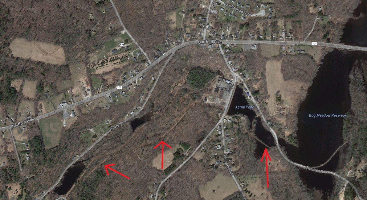
I believe the structure north of Bear Hill Road along Bog Meadow Pond is not the trolley line, but instead a dam to form another pond to the southwest of Bog Meadow Pond. I believe the trolley ran over Bear Hill & East Killingly Roads to present day RI Route 94 where it headed south to Foster Center (and on to Providence).
3 comments:
Hello,
Little late in bringing this up, but I believe the "dam" IS a causeway for the Providence & Danielson. If you look at the 1934 aerial, you can see that the line ran cross-country, in the general direction you describe but not along Bear Hill Road. Here's the link:
http://cslib.contentdm.oclc.org/cdm/singleitem/collection/p4005coll10/id/2946
Street Railway Review, May 20, 1903, p. 153, published a map of the whole route (before the Scituate Reservoir rerouting). It's available in Google Books:
https://books.google.com/books?id=aEE_AQAAMAAJ&lpg=PA153&ots=nP3CFV08nd&dq=providence%20danielson%20railway%20route&pg=PA153#v=onepage&q=providence%20danielson%20railway%20route&f=false
BRUCE CLOUETTE
Awesome!
I'm sure you're right looking at the aerial photo, and I'm a bit amazed I hadn't thought to check those before (I've it often for other things!)
Thanks Bruce.
Also, a complete map on this, from David Rumsey's site: https://www.davidrumsey.com/luna/servlet/detail/RUMSEY~8~1~247019~5515224:Sheet-5--Scarborough-s-Complete-Roa?sort=pub_list_no_initialsort%2Cpub_list_no_initialsort%2Cpub_date%2Cpub_date&qvq=q:Rhode%20Island%201905;sort:pub_list_no_initialsort%2Cpub_list_no_initialsort%2Cpub_date%2Cpub_date;lc:RUMSEY~8~1&mi=6&trs=8#
Post a Comment